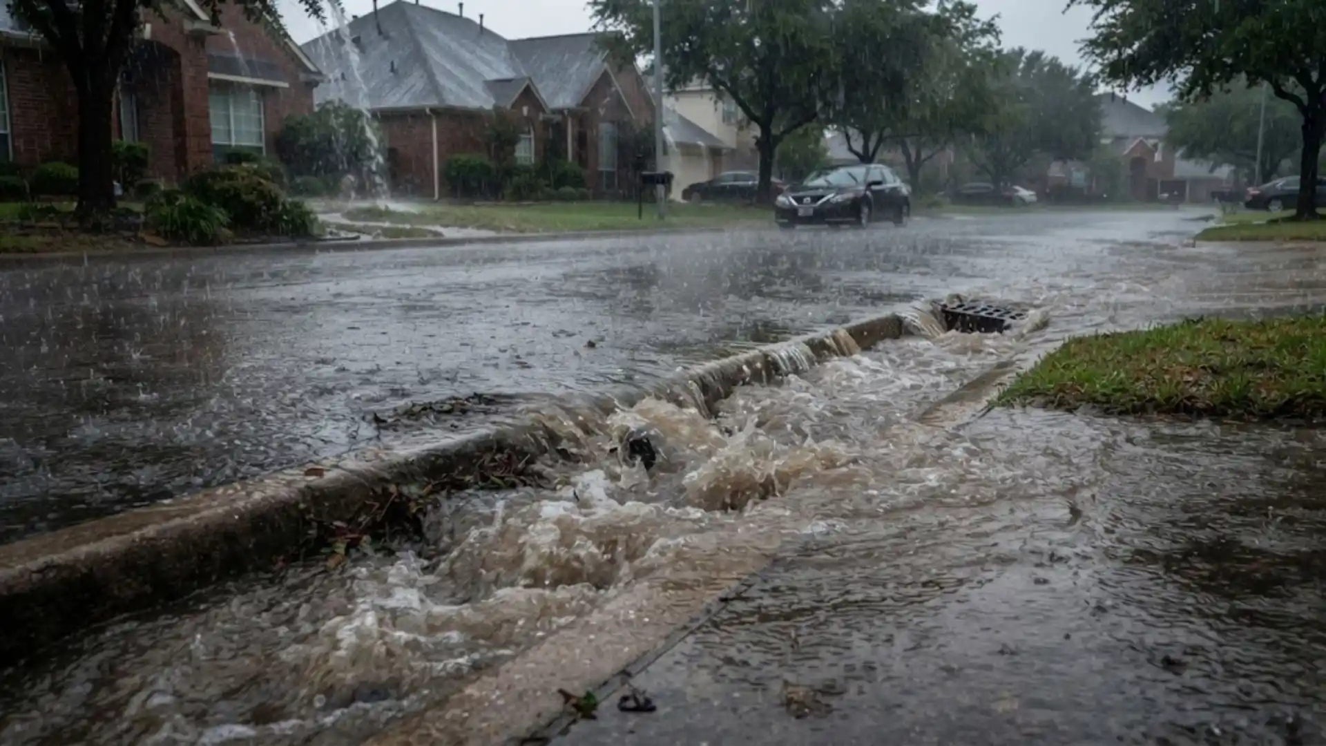
Utah County's summer weather pattern confuses a lot of people who move here from wetter climates: the region's overall summer rainfall is fairly modest, yet Pleasant Grove and neighboring cities still see genuinely damaging flash flooding some summers, including the August 2024 storm that overwhelmed drainage across Pleasant Grove, Lindon, and Orem. The explanation isn't that Utah gets more rain than people expect, it's that the rain that does fall during monsoon season tends to arrive all at once.
What Makes A Monsoon Storm Different From Steady Rain
Utah's summer monsoon pattern, driven by moisture pulled up from the Gulf of California and Gulf of Mexico, tends to produce intense, localized thunderstorms rather than the steady, spread-out rain more common in other regions. A storm can dump several inches of rain in under two hours over a fairly small area, while a neighborhood just a few miles away sees comparatively little. This concentrated intensity is exactly what overwhelms storm drains designed around more typical, gradual rainfall patterns rather than short bursts of extreme volume.
The Role Of Microbursts
A microburst is a sudden, powerful downdraft of air from a thunderstorm that hits the ground and spreads outward, sometimes producing wind speeds comparable to a tornado over a small, concentrated area. Microbursts often accompany the kind of intense summer storm cells common in Utah County, and the combination of sudden intense rain and damaging straight-line wind can affect a property on two fronts simultaneously, wind damage to roofing or siding at the same time heavy rain is testing that same roof's ability to shed water quickly.
Why This Overwhelms Storm Drains Specifically
Municipal storm drain systems are generally engineered around a expected rainfall intensity based on historical data for the area, and Utah County's older storm infrastructure in particular wasn't necessarily designed for the kind of short, extremely intense burst a monsoon storm can produce. When rainfall arrives faster than a drainage system's design capacity, water backs up at street level and finds alternate paths, often directly toward the nearest low point, which is frequently a residential window well or a low-lying foundation.
Why This Matters For Storm Preparedness
Because monsoon storms are often localized and can develop relatively quickly compared to a large, slow-moving weather system, there's sometimes less advance warning than homeowners get before a more predictable, widespread storm. Keeping window wells clear and functioning, as covered in more detail in one of our other posts, matters more during monsoon season specifically because there's less time to react once a storm cell is actually overhead.
What To Do If A Storm Has Already Caused Damage
Storm damage restoration addresses both the wind and water sides of a monsoon event, since the two often arrive together rather than as separate incidents. We assess roof and siding damage alongside any water intrusion, since insurance claims for a single storm event typically bundle both types of damage together rather than treating them as unrelated losses.
This same monsoon pattern affects the entire Wasatch Front, including neighboring Lindon, which experienced direct flooding at its own City Center during the same August 2024 event that hit Pleasant Grove.
How To Get Warning Before A Monsoon Storm Hits
Because monsoon storms can develop and intensify faster than more typical weather systems, relying on a general daily forecast isn't always enough advance warning. Weather apps with real-time radar and severe weather alerts tend to give more useful lead time during monsoon season specifically, since they can flag a rapidly intensifying storm cell an hour or less before it arrives rather than just noting general afternoon thunderstorm chances for the day. If you know a storm cell is approaching, even 20 or 30 minutes of advance notice is enough time to clear a window well of loose debris or move vulnerable items away from a known problem area.
What Utah County Has Done Since The August 2024 Storm
Following the August 2024 storm that overwhelmed drainage across Pleasant Grove, Lindon, and Orem, affected cities increased attention on storm drain maintenance, including more frequent street sweeping specifically aimed at keeping inlets clear ahead of forecasted storm activity. While infrastructure upgrades to handle a monsoon-intensity event take longer to implement than maintenance improvements, increased proactive drain clearing during monsoon season has been one practical, faster response some Utah County cities have adopted since that event, though individual property owners still carry the primary responsibility for their own window wells, gutters, and grading regardless of municipal drain maintenance.
Building A Simple Monsoon-Season Habit
During monsoon season specifically, roughly July through September, make a habit of glancing at the radar or a weather alert app each afternoon, since that's when Utah's monsoon storms most commonly develop. This small daily habit costs almost nothing and can give you the short lead time needed to clear a window well or move something vulnerable before a storm cell actually arrives.
And if a microburst does cause wind damage to your property, document it alongside any water intrusion, since the two are often part of the same insurance claim and separating them unnecessarily can complicate what should be a single, straightforward claim process.
If you're new to Utah or unfamiliar with monsoon season, it's worth simply knowing the pattern exists. Summer afternoons and early evenings, particularly in July and August, are when these storms are most likely to develop, which is a reasonable time to keep half an eye on the sky if you have outdoor plans or known drainage concerns at home.
Utah's monsoon season is a normal part of the region's summer weather pattern, not an unusual event, which makes basic seasonal preparedness a reasonable habit rather than an overreaction to a rare occurrence.
The Bottom Line
Utah's relatively modest average summer rainfall doesn't mean low flood risk, monsoon storms concentrate that rainfall into short, intense bursts that older drainage infrastructure wasn't built to handle, which is exactly the pattern that produced Utah County's August 2024 flooding event.